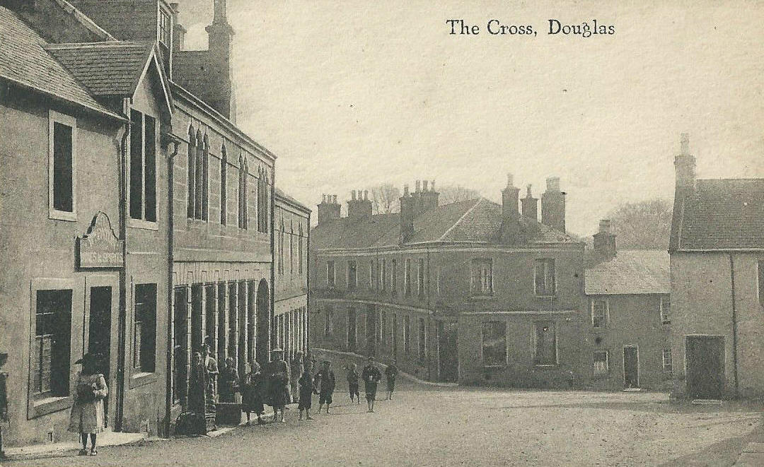
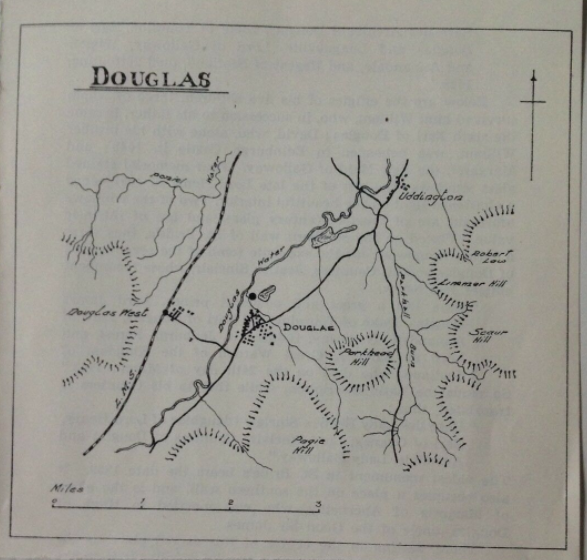
Douglas
is a village in South Lanarkshire, Scotland. It is located on the
south bank of the Douglas Water and on the A70 road that links Ayr,
on the West coast of Scotland, to Edinburgh on the East, around 12
miles south west of Lanark. The name Douglas is of Gaelic origin, dhu-glas meaning black water. The Douglas family took this name when
their ancestors settled here in the 12th century.
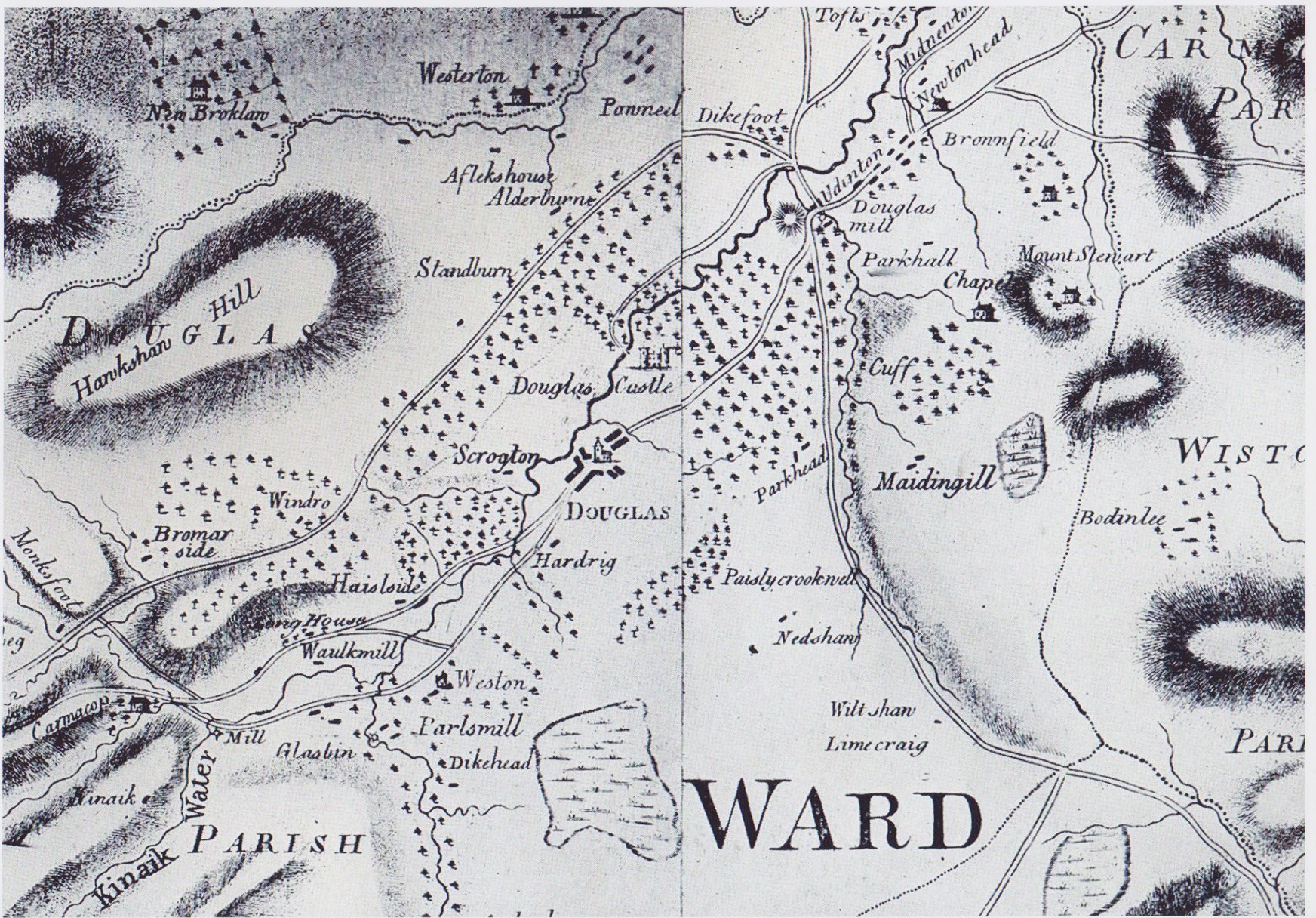
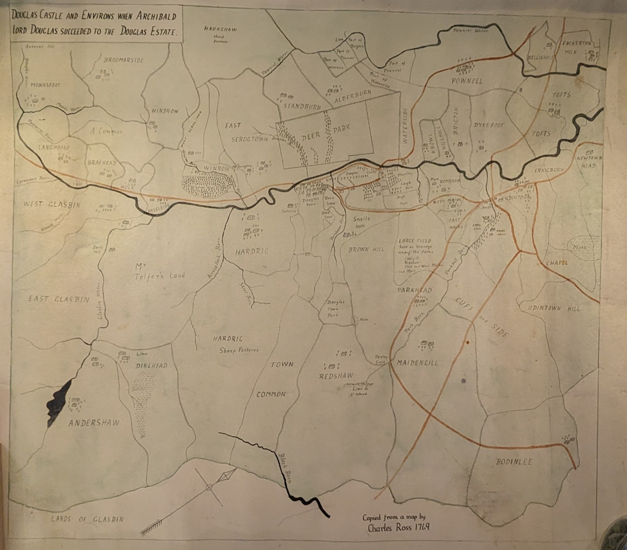
In medieval
times, the village grew to service the nearby
Douglas Castle, the
seat of the "Black Douglas" Earls of Douglas. The castle and village
were well established by 1300, and were occupied for some time by
English forces during the Scottish Wars of Independence. However the
castle was liberated by Sir James Douglas when in 1307 he and some
followers trapped the English garrison inside the Castle chapel
whilst they were worshiping and burnt it to the ground, causing some
damage to the castle.
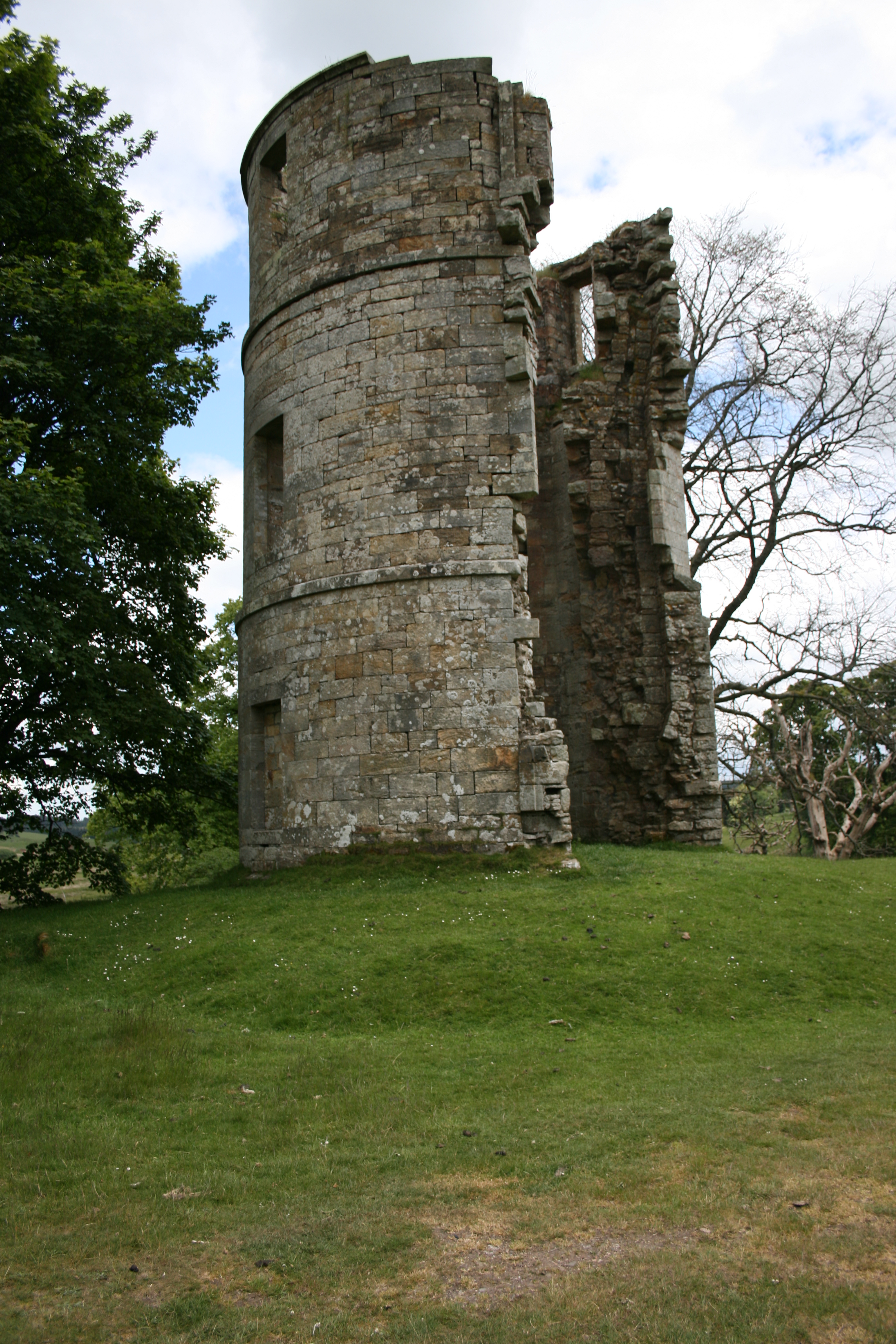
The only remains now are those of a
17th century corner tower, still known as "Castle Dangerous", after
the Walter Scott novel which took Douglas Castle as its inspiration.
In the 1930s Charles Douglas-Home, 13th Earl of Home allowed the
mining of coal in the park near to the castle, in a philanthropic
effort to alleviate local unemployment. The Lanarkshire coal
industry, once the mainstay of Scotland's production, had seen its
output almost halved by 1937, with catastrophic consequences for
local communities. As a consequence of the mining works the castle
was considered to be at risk of subsidence and had to be demolished
in 1938.
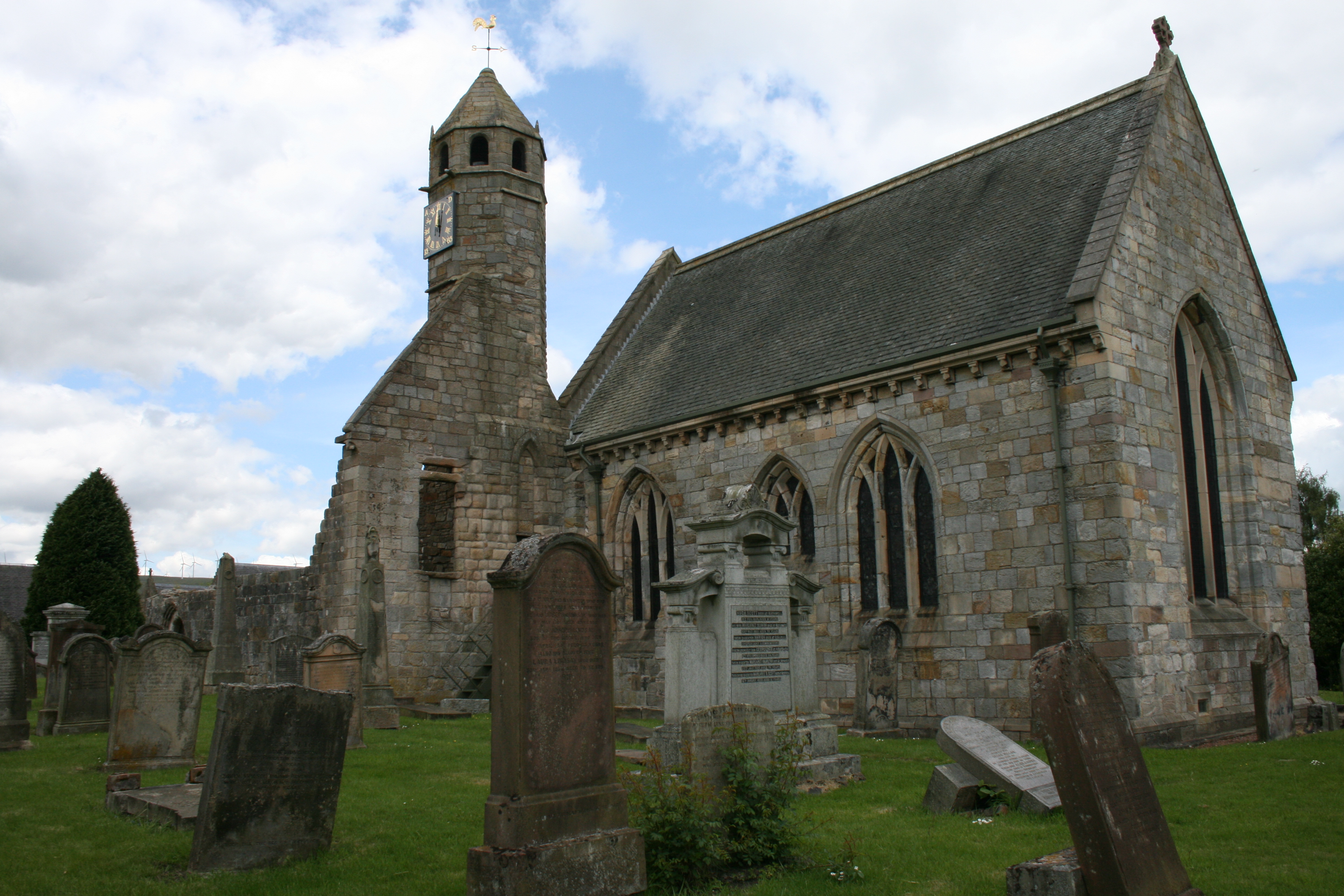
The oldest structure within the village itself is
the ruin of St. Brides Church, which like the castle originated in
the 1300s. This church became the mausoleum of the Black Douglases.
The church clock, which is still in working order today, and
installed sometime in the 1500s, is rumoured to have been given as a
gift to the village by Mary, Queen of Scots, after spending time in
the area. The parish church was moved to its present site, near to
the old chapel, where the Douglas St Brides Parish Church still
stands. Its congregation now worships at the newer St Brides Church
built some distance away.
Within the village stands a statue
to one of the Covenanters, James Gavin who was persecuted for his
religious faith and had his ears cut off with his own tailoring
scissors for refusing to renounce it. After suffering this
humiliation he was transported to a life of slavery in the cotton
fields of the West Indies. The ruins of his house stood until 1968
with the tailor's engraved lintel still in place above the front
door. The lintel has been incorporated within the monument erected
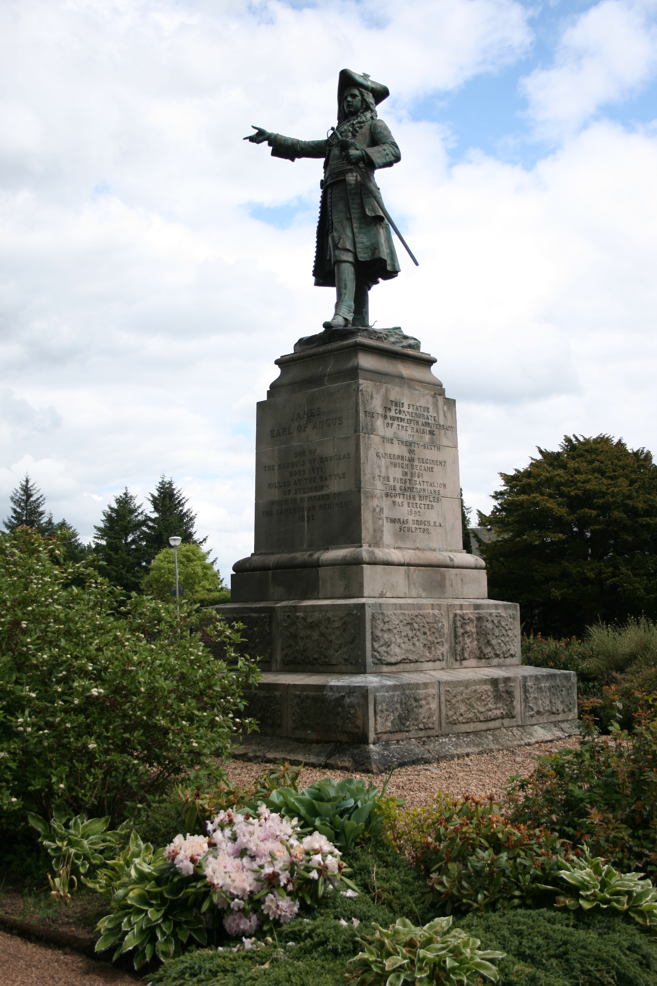
in the rear garden of the house. Also within the village is a statue
of James Douglas, Earl of Angus, commemorating
the Cameronians
regiment which he raised in 1689. Nearby, another memorial
commemorates the disbanding of the Cameronians in 1968.
The
village was shaped later by the Industrial Revolution, which brought
woolen mills and coal mining (in common with other villages in this
part of Scotland). There is a heritage museum in Douglas that charts
the history of the area.
Only the choir and spire remain of the
12th-century church of St
Bride, the patron saint of the Douglases. The vault beneath the choir was,
until 1761, the burial-place of the family. A silver case said
to hold the ashes of the heart of the “good Sir
James” (I 286—1330) was located here, but is now on display
within the church itself. In 1870, the choir was restored and the tombs
(including that of Sir James Douglas) repaired.
Read more>>>
David Hackston of Rathillet, the Covenanter, is stated to have been captured
in the village (in a house still standing) after the battle of
Aird’s Moss in
1680. On the hill of Auchensaugh (1286 ft.), 21/8 m. S.E., the Cameronians
assembled in 1712 to renew the Solemn League and Covenant. This gathering, the
“Auchensaugh Wark,” as it was called, led up to the secession of the
Reformed Presbyterians from the Kirk.
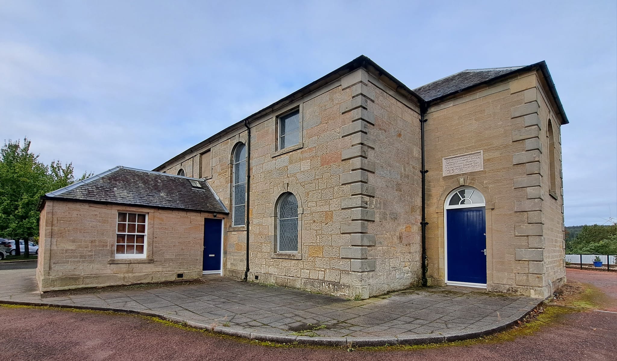
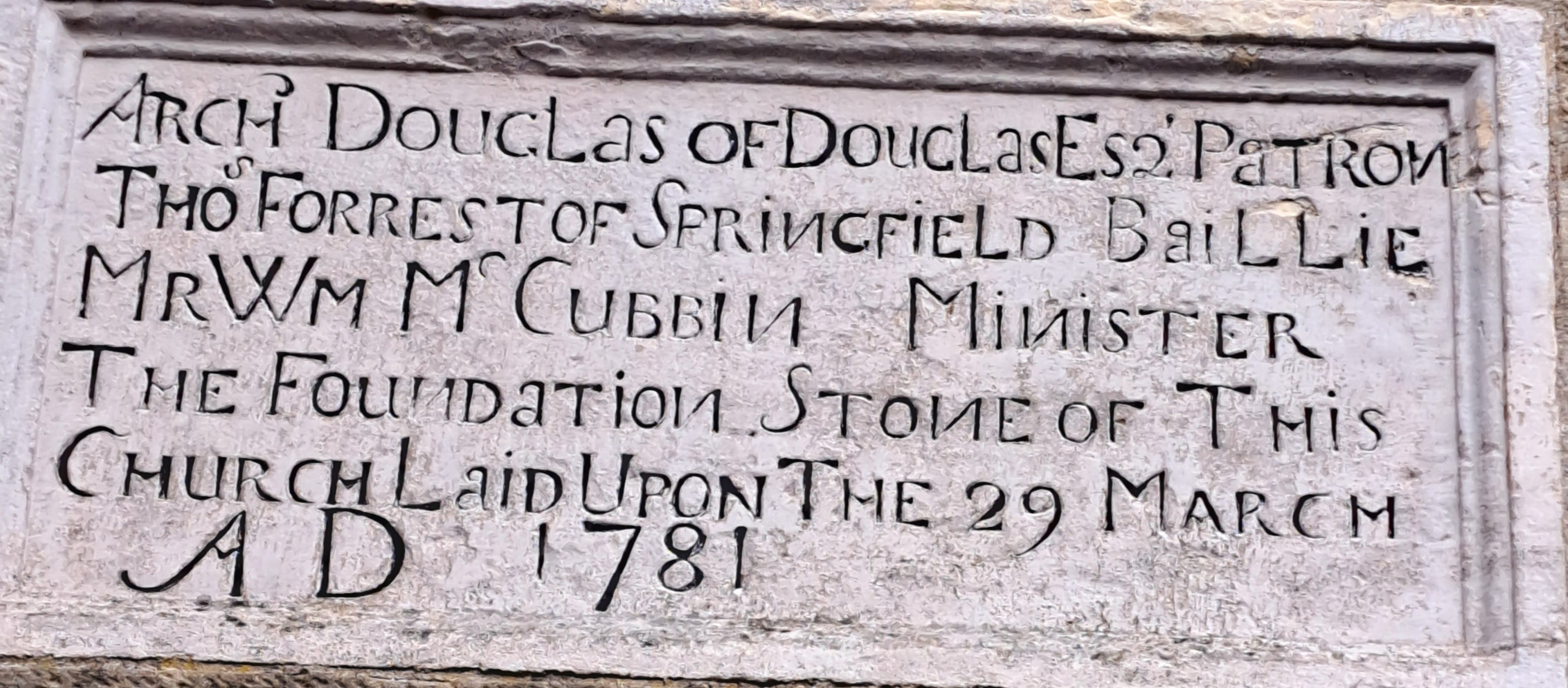
I have not yet identified this building. What was it?
What is it used for now?
|